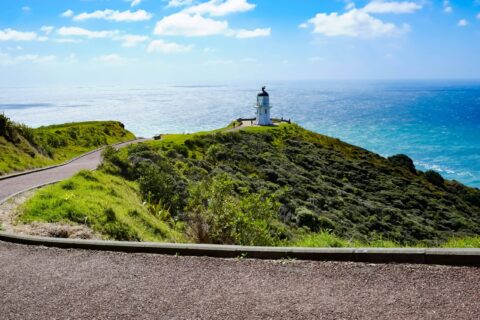
The Far North of New Zealand is often overlooked. Northland and North Auckland are a sub-tropical tapestry of untouched beaches, rugged coastlines and emerald waters, alongside Māori history. Our suggested route runs from Auckland to Matakana and Whangārei Heads, out to the Poor Knights Islands, through the Bay of Islands and up to the top of the Far North at Cape Reinga where two great oceans collide. From there it’s down the west coast through ancient kauri forests and back to Auckland to finish. We’ve based it on six to eight days, and we think it’s one of the best loops New Zealand has to offer.
By James O’Hern · General Manager, Quirky Campers NZ · Published October 2026
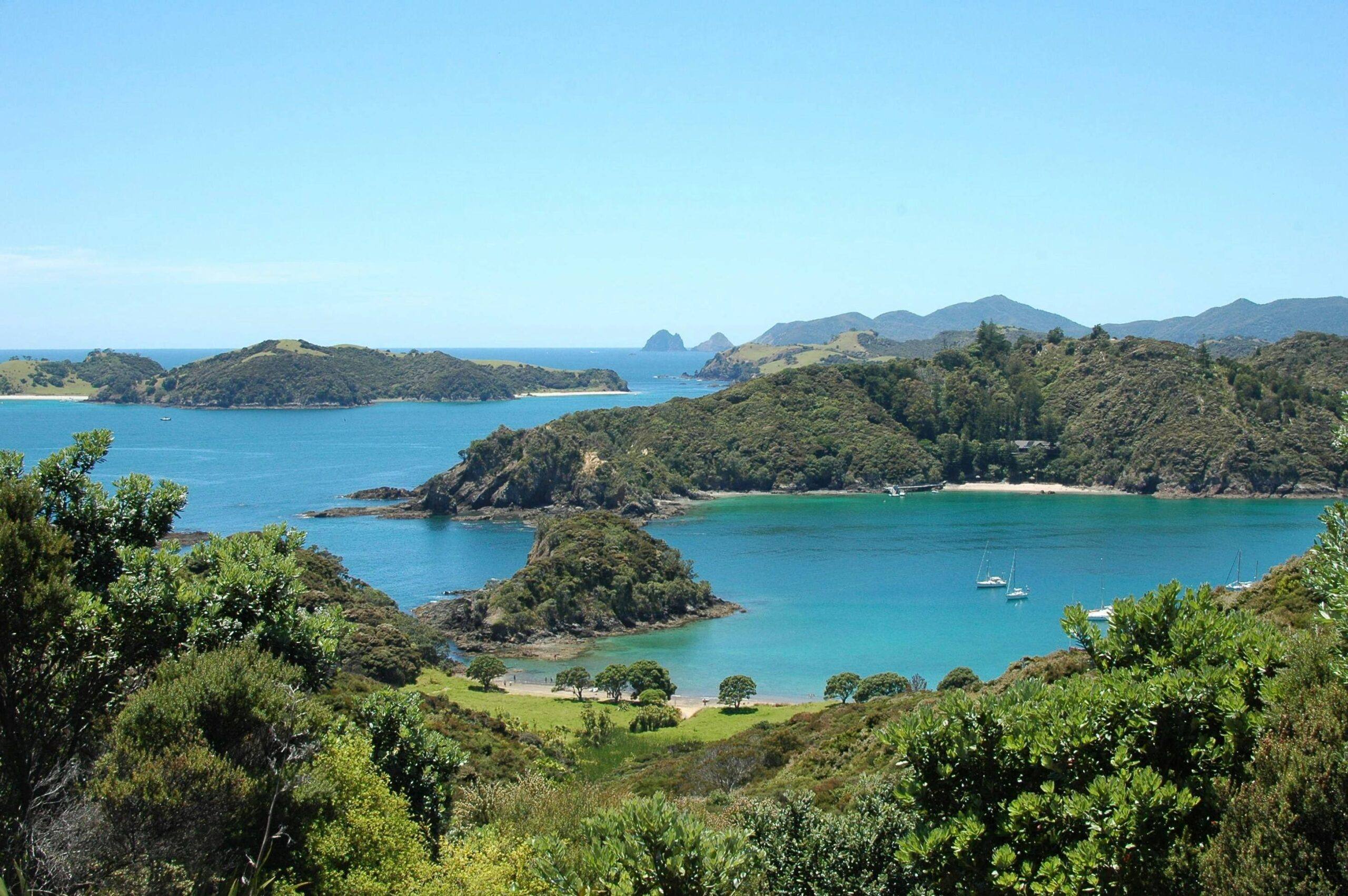
The top of the North Island boasts a lovely sub-tropical climate, giving it a reputation for being the ‘winterless north’. Like much of New Zealand it offers a coastline that relentlessly folds back on itself into peaceful bays, inlets and harbours.
This is also where a great deal of New Zealand’s story begins. The Treaty of Waitangi, New Zealand’s founding document, was signed in Northland in 1840. Further north, Cape Reinga is one of the most spiritually significant places in the country. Northland’s west offers some of the last stands of ancient kauri forest, including a tree that was already old when the first people arrived.
Take a look at our suggested route. Some guests do the full loop, others pick half and take their time. Use the interactive map to see what sits where, then decide what to keep, what to skip and what to add.
Route: Auckland → Matakana → Tāwharanui → Waipu → Whangārei Heads → Tutukākā → Bay of Islands → Karikari Peninsula → Cape Reinga → Kai Iwi Lakes → Waipoua Forest → Auckland
Trip length: 6 to 8 days
Driving distance: 1,100 to 1,300 km (depending on your route)
Longest drive: The west coast run home from Cape Reinga.
Pacing: Mostly single nights heading north, with the option to slow down in the Bay of Islands and the Far North
Jump to a stop on the route
Day 1: Matakana and Tāwharanui
An hour north of Auckland and the pace starts to slow. First you’ll find Matakana, a small town with a food scene out of proportion to its size: cellar doors, a Saturday farmers market worth planning around, and a handful of great restaurants and cafés.
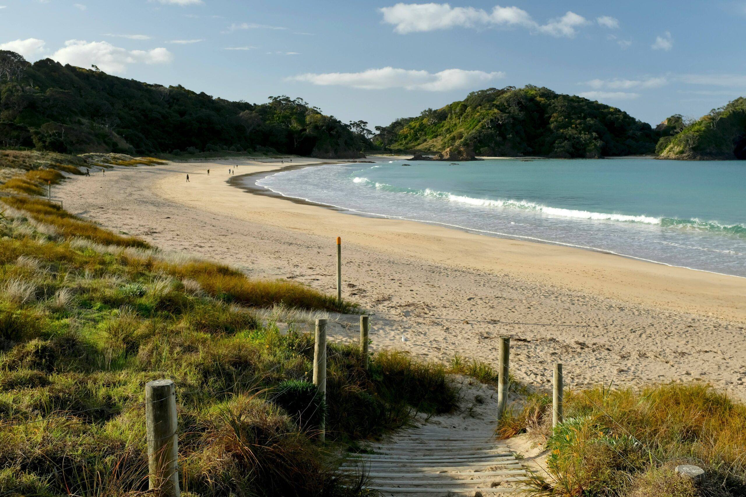
Twenty-five minutes further on, Tāwharanui Regional Park sits on a peninsula with a predator-proof fence creating a sanctuary for native birds which means kiwi, takahē and bellbirds live there alongside walkers and campers. The dawn chorus at the campground is something else. Anchor Bay is a long curve of white sand with surf at one end and rock pools at the other.
The campground sits just behind the dunes and fills up over summer so book ahead.
Suggested stay: One night at Tāwharanui Campground
Approximate drive: 85 km from Auckland, around 90 minutes
Day 2: Mangawhai, Waipu and Uretiti

Start with breakfast at Toast of Wood Street in Mangawhai. Carry on to Waipu, which has an unusual history. The town was founded in the 1850s by Scottish Highlanders who had first emigrated to Nova Scotia, then sailed on to New Zealand in ships they built themselves. The Waipu Museum tells the story, and the Highland Games are still held here every New Year’s Day.
The Waipu Coastal Walkway runs between Waipu Cove and Langs Beach, an easy out-and-back along the clifftops that works well with children. McLeod’s Pizza Barn and Brewery is in the village – no prizes for guessing what they sell!
Finish fifteen minutes up the road at Uretiti, a DOC campsite is tucked behind a long stretch of open beach with simple facilities, lots of space, a very long beach and lots of stars on a clear night.
Suggested stay: One night at Uretiti DOC campsite
Approximate drive: 95 km, around 90 minutes with stops
Day 3: Whangārei Heads
The Heads are a cluster of eroded volcanic peaks and small coves at the mouth of Whangārei Harbour, and they see fewer people than the Bay of Islands further north if you enjoy the quieter spots.
Mount Manaia is the peak you can see from everywhere, a jagged outcrop of rock pinnacles above the harbour. In Māori tradition the peaks are Manaia, a tūpuna and rangatira of Ngātiwai, turned to stone alongside his family and his servant Paeko. It is a steep climb of between 60-90 mins return, mostly on steps, and the view from the top takes in the harbour, the coast and the islands offshore. Go early before the heat in the summer months.
For something longer, the Peach Cove Track drops through bush to a sheltered cove with a DOC hut option. You can book the hut and stay the night, which is a lovely way to spend an evening if you have the time.
Reotahi is a designated freedom camping spot on the water at the Heads, and it faces west for the sunset.
Suggested stay: One night at Reotahi freedom camp
Approximate drive: 55 km, around an hour
Day 4: Tutukākā and the Poor Knights Islands
The Poor Knights Islands sit 23 kilometres off the coast, and they are unlike anywhere else in New Zealand.
The islands are the eroded remains of a rhyolitic volcano that erupted some four million years ago, leaving cliffs riddled with caves, tunnels and archways, some large enough to take a boat through. The East Auckland Current, a cousin of the one Finding Nemo made famous, sweeps warm water down from the subtropics, which brings fish you would not otherwise see this far south. Hundreds of species have been recorded, and visibility often runs to 25 or 30 metres. Jacques Cousteau rated it among the best subtropical diving in the world.
Nobody has lived on the islands since the 1820s, and they have stayed free of rats and stoats ever since, which makes them a stronghold for seabirds. Buller’s shearwaters breed nowhere else on earth.
Dive! Tutukaka run trips out daily and you do not need to be a diver. The snorkelling is excellent and the boat takes you into the sea caves.
Back on land, Whale Bay and Sandy Bay are ten minutes up the coast. Whale Bay takes a short walk through bush to reach, which keeps the numbers down. Sandy Bay is the surf spot.
Suggested stay: One night near Tutukākā or Matapouri
Approximate drive: 45 km, around 50 minutes
Day 5: Paihia, Waitangi and Russell
This is the part of Northland most people have heard of, and it earns the attention, though it is only one chapter of the story.
The Waitangi Treaty Grounds are where the Treaty of Waitangi was signed in February 1840 between the British Crown and more than 500 Māori rangatira. It remains the founding document of modern New Zealand and the basis of a great deal of current law and politics. The guided tour and the cultural performance are both worth seeing.
Paihia is the base for boat trips out into the bay and a passenger ferry runs across to Russell, which in the 1830s was a whaling port with a reputation rough enough to earn it the name “the hell hole of the Pacific”. It is now about as quiet and beautiful as New Zealand gets. Sage Restaurant on the waterfront is the splash-out dining option and Sandwich Craft does a good lunch back in Paihia.
If you want a serious walk, the Cape Brett Track runs out along the peninsula to a lighthouse and a DOC hut at the end. It is 16 km each way. It takes around eight hours in each direction and is hard going throughout. Most people stay at the hut and take a water taxi one way to save the knees! Book both well ahead as this walk is popular during the summer months.
Suggested stay: One or two nights around Paihia
Approximate drive: 70 km, around an hour
Day 6: Kerikeri to the Karikari Peninsula
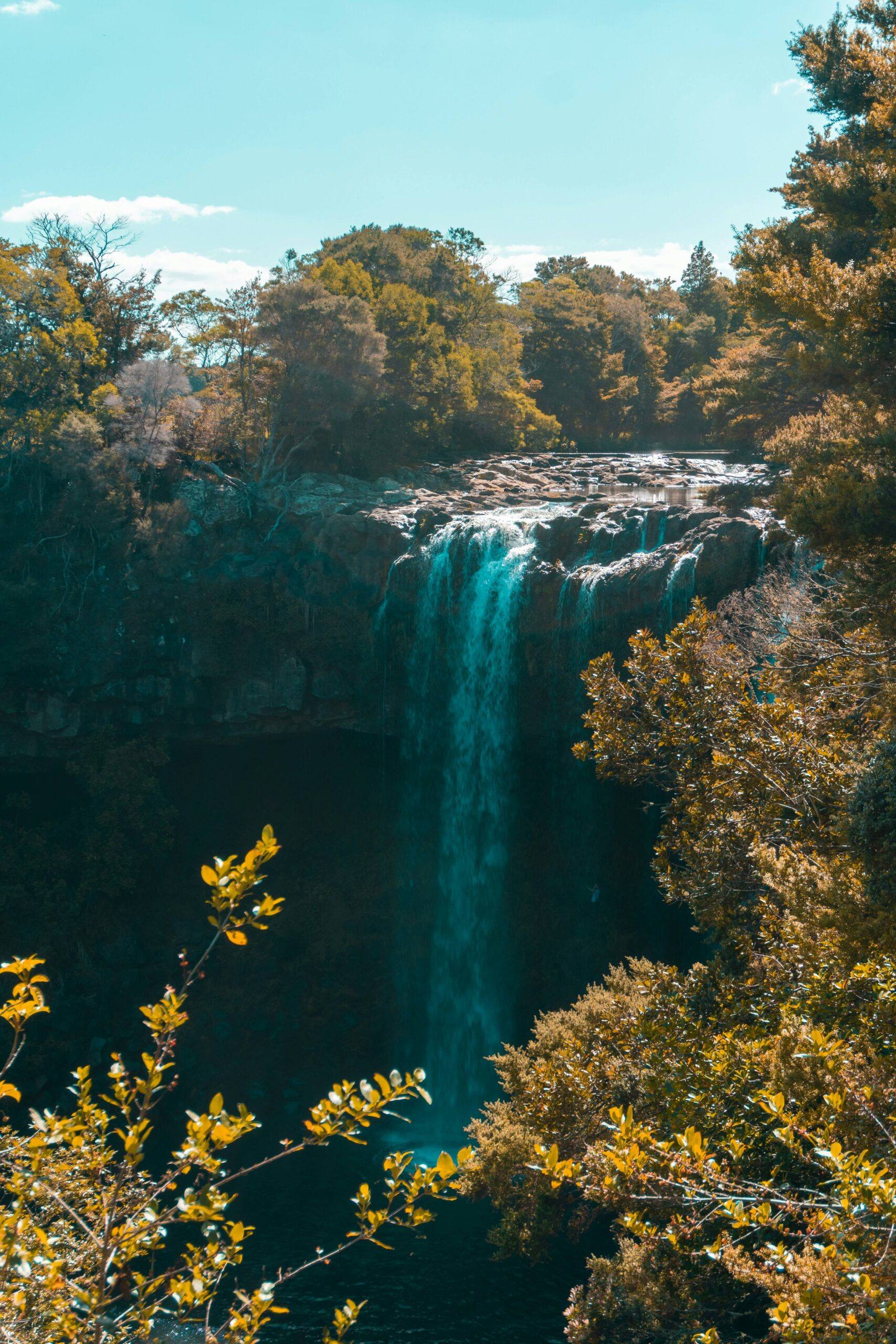
Head north and the roads get quieter still. Kerikeri is worth a stop, with The Stone Store on the river the oldest stone building in New Zealand, finished in 1836, and the mission house beside it is older still. Rainbow Falls is a short walk from town. The Old Packhouse Market is good for breakfast and local produce.
If you fancy a leg stretch, Duke’s Nose at Whangaroa is a short, steep scramble with chains near the top and a view over the harbour that repays the effort of the clamber.
Matauri Bay is a worthwhile detour for the beach and for the Rainbow Warrior memorial on the headland. The ship, sunk by French agents in Auckland in 1985, was later scuttled off the Cavalli Islands just offshore and is now a dive site.
Lunch at the Mangonui Fish Shop built out over the harbour on piles which boasts New Zealand’s best fish and chips. Then out onto the Karikari Peninsula. Maitai Bay is a double horseshoe of white sand with a DOC campsite behind it. Nearby, Rotopokaka is a small freshwater lake stained the colour of tea by the surrounding scrub, warm as a bath and a short walk from the ocean. Tokerau Beach has a designated freedom camping spot if that’s your vibe.
Suggested stay: One or two nights at Maitai Bay
Approximate drive: 140 km, around two and a half hours with stops
Day 7: Cape Reinga and the Far North
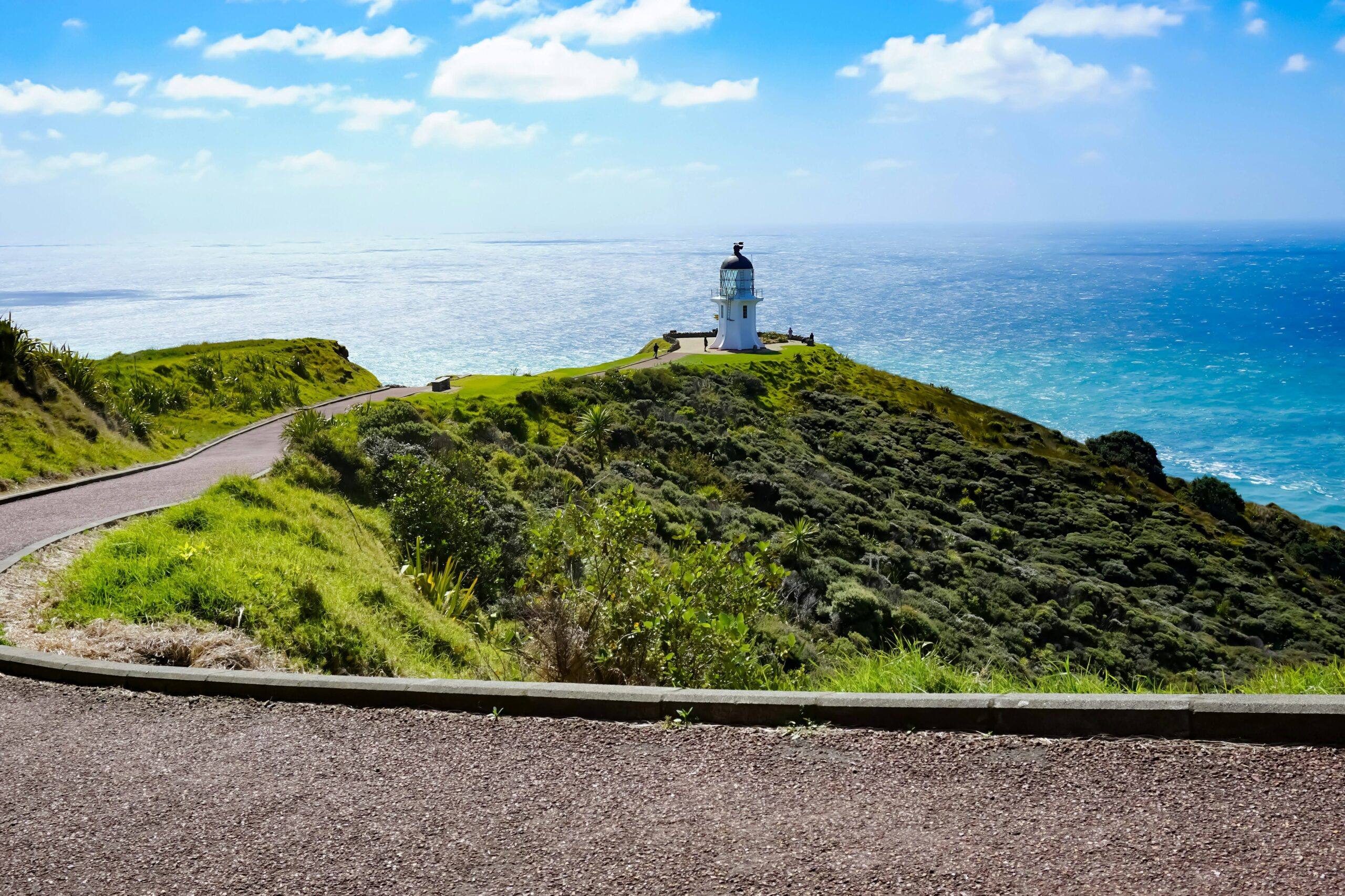
The drive up SH1 through the Aupōuri Peninsula runs between pine forest and dunes, with the sea somewhere out to your left most of the way. Cape Reinga, or Te Rerenga Wairua, is where the Tasman Sea meets the Pacific Ocean. On a windy day you can watch the two currents collide offshore in a churning line of white water. The lighthouse sits at the end of a short sealed path from the car park.
Te Rerenga Wairua means the leaping-off place of spirits and this is the most spiritually significant site in the country for Māori. In tradition, the spirits of the dead travel north along Te Ara Wairua, the spirits’ pathway, and at the cape they descend the roots of an ancient pōhutukawa clinging to the cliff face. That tree is thought to be around 800 years old. From there the spirits travel to Manawatāwhi in the Three Kings Islands to take a final look back at the land, before returning to Hawaiki. Out of respect, visitors are asked not to eat or drink anywhere on the headland.
The Te Paki sand dunes nearby are enormous and you can hire a board and slide down them.
One thing to know: Ninety Mile Beach is a forbidden road in a Quirky campervan. The tide and soft sand catch people out every year, and no rental company permits it. Our guide to driving a campervan in New Zealand has more on this.
Stay at Tapotupotu, the northernmost campsite in New Zealand, in a bay just below the cape. The access road is short, steep and unsealed, so take it gently.
Suggested stay: One night at Tapotupotu
Approximate drive: 110 km, around 90 minutes
Day 8: Home down the Kauri Coast
Come back down the west coast rather than retracing your steps. It is a different landscape and it makes the loop worth doing as a loop. Break the drive at the Kai Iwi Lakes, three freshwater dune lakes sitting above the sea with white sand beaches and clear blue water. A swim there after a week of salt water is a treat.
Then into Waipoua Forest to meet Tāne Mahuta, the largest living kauri known. It stands around 50 metres tall with a trunk close to 14 metres around, and is estimated to be somewhere between 1,200 and 2,500 years old. Kauri forest once covered more than a million hectares across the top of the North Island. Very little is left. Tāne Mahuta is a five minute boardwalk from the road, and the scale of it does not come across in photographs.
Use the shoe cleaning stations at either end, every time, as kauri dieback is spread by soil carried on footwear. Please help to protect our native trees.
Cape Reinga to Auckland down the west coast is around six hours of driving. Plenty of people split it with a night at Kai Iwi Lakes, which makes this a nine day trip and is the better way to do it if you have the time.
Approximate drive: 490 km, around six hours of driving
Doing it in six days instead of eight
Tight on time? The loop still works with a couple of changes.
- Combine Matakana and Waipu into a single day, staying at Uretiti on night one
- Skip Whangārei Heads and head straight from Uretiti to Tutukākā
If you are really pushed, the better option is to stop at the Bay of Islands and turn round rather than rushing the Far North. Cape Reinga and the Karikari beaches are the quiet heart of this route and they reward a proper visit.
Where to stay along the way
Northland is one of the better regions in the country for freedom camping, and every Quirky van is certified self-contained to the green sticker standard, so designated sites are open to you alongside holiday parks and DOC campsites.
Worth knowing: some DOC campsites on this route are bookable and others are first come, first served. Maitai Bay and Tāwharanui both fill up over summer. Book what you can and have a backup for what you cannot.
Our freedom camping guide covers the current rules, the fines and how to find genuinely free sites.
A few things worth knowing before you go
- Ninety Mile Beach is off-limits. It is on our forbidden roads list and on every other rental company’s too. Take a tour if you want to see it.
- Book the Poor Knights ahead. Trips depend on the weather and do get cancelled.
- Clean your boots at every kauri station. These trees have no defence against dieback.
- Northland roads are narrower and windier than the map suggests. Allow more time than you think, particularly on the Karikari and Whangaroa side roads.
- Fuel up in the bigger towns. Stations thin out north of Kaitaia and along the Kauri Coast.
Ready to head north?
Quiet beaches, warm water, ancient forest and the place where two oceans meet, all within a week of Auckland.
Browse our Auckland campervans and pick the one you fancy waking up in.
Northland road trip FAQs
How long do you need for a Northland road trip?
Six to eight days is enough for a comfortable loop from Auckland up to Cape Reinga and back down the west coast. Nine days is better, because it lets you split the long drive home with a night at the Kai Iwi Lakes. A shorter version works in four days by turning round at the Bay of Islands.
Can I drive a campervan on Ninety Mile Beach?
No. Ninety Mile Beach is on Quirky Campers NZ’s forbidden roads list and is excluded by every campervan rental company in New Zealand. Vehicles are lost to the tide and to quicksand at Te Paki Stream every year, and insurance would not cover it. The bus tours from Kaitaia cover the beach and the sand dunes with drivers who know the conditions.
What is the best time of year to visit Northland?
Northland is the warmest part of New Zealand and travels well from October through to May. December and January are busiest, so book campsites ahead. March and April tend to be the sweet spot, with warm water, settled weather and fewer people about.
Do I need to be a diver to visit the Poor Knights Islands?
No. Dive! Tutukaka run snorkelling and sightseeing trips alongside their diving, and the boat takes you into the sea caves either way. You cannot land on the islands themselves, as they are a protected nature reserve. Book ahead and allow a spare day, since trips depend on the weather.
Is the Cape Brett Track suitable for all walkers?
No, it is a demanding tramp. The track runs 16 km each way along an exposed ridge and takes around eight hours in each direction, with significant climbing throughout. Most people stay overnight at the DOC hut and take a water taxi one way. Book the hut and the taxi well in advance, and only take it on if you are a confident walker.
Can I freedom camp in Northland?
Yes, and Northland is one of the better regions for it. Every Quirky van is certified self-contained to the green sticker standard, so designated sites are open to you. Rules still vary by district, so check a spot on CamperMate or Rankers before settling in for the night.
